
-
ScienceAlert
Extreme Heat Is The Deadliest Weather Hazard in The US, And Scientists Think We're Unprepared
Jennifer Marlon and Nicolas Begotka’s findings on the mismatch between heat risk perceptions and the real risk reveal public unpreparedness for heat.
-
National Wildlife Federation
Streams Critical to Des Moines’ Drinking Water No Longer Protected by the Clean Water Act – New Research
Streams no longer protected by the Clean Water Act may play a major role in Des Moines’ drinking water supply.
-
West Virginia Explorer
Charleston’s drinking water depends on thousands of small mountain streams
YCGS mapped Elk River headwater streams that help supply Charleston’s drinking water, many of which may lack federal Clean Water Act protections.
-
Earth.com
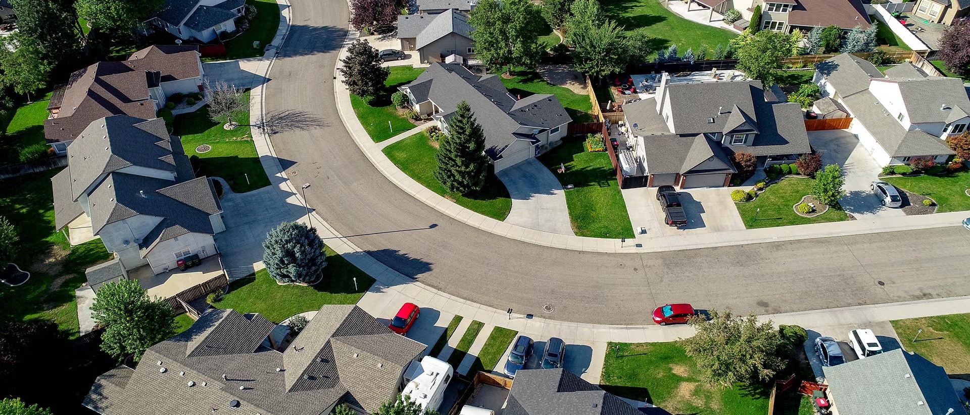
Suburban street design quietly fuels climate pollution
Arianna Salazar-Miranda finds suburban street design, not just distance from downtown, drives close to 38 percent of suburban climate emissions.
-
Yale And The World
Spring 2026 Yale and the World Partnership Fund awardees announced
Yale’s Office of International Affairs awards seed funding to 10 global projects spanning AI, public health, climate, and cultural heritage.
-
The Suburban Street Design That’s Been Driving Emissions Since WWII
Arianna Salazar-Miranda’s research finds that 38 percent of suburbs’ environmental costs are a result of street design, not only suburban sprawl.
-
Meet the 2026-2028 Cohort of YPS Doctoral Fellows
Our Drone Facilitator, Skye Hellenkamp, has received the Stella M. Hammond Planetary Solutions Fellowship!
-
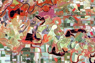
Scientists can now measure the “urban pulse” from space
Learn more about the use of high-frequency satellite data to measure the “urban pulse”, a new framework developed by researchers at UConn and Yale.
-
Taking the Urban Pulse: A New Way to Diagnose Cities
A YSE-led study introduces the “Urban Pulse”, a new framework to monitor urbanization in a continuous manner rather than with static figures.
-
Sudan's drone war: How unmanned aircraft became the deadliest weapon against civilians
Nathaniel Raymond’s forensic analysis of satellite imagery shows how drones have made attacks on civilians in Sudan deadlier and more traceable.
-
Building maps to connect New Haven’s past with the present
Learn more about the New Haven Digital Atlas, an interactive map created by Yale’s New Haven Environmental History Project.
-
Experience-driven perceptions misalign with assessed heat risk in the United States
Climate change is pushing heat risk beyond what many communities recognize, preventing people from adequately preparing for future heat danger.
-
Heat Risk Perception Gap
Understanding where assessed heat risk and public concern align can help guide effective communication, planning, and climate adaptation.
-
CT researchers studied Earth’s nighttime light patterns. They found a tug-of-war on a global scale
More light meant more development, but that is no longer always the case, instead earth’s nighttime lights have become more volatile.
-
Li Murphy ’26 MESc: Transforming the West’s Understanding of its Most Mythologized ‘Pest’
Li Murphy, our drone facilitator, crawls into Mormon cricket swarms to understand what they see, why they march, and how they can be managed.
-
A storied street
The historic Graves-Gilman House at 37 Hillhouse Avenue, built in 1866 and newly renovated in 2025, now houses Yale Center for Geospatial Solutions.
-
Updated Yale Climate Opinion Maps for 2025
The latest Yale Climate Opinion Maps (YCOM) update has been released, featuring four new measures of climate change beliefs.
-
YCNCC News
The Importance of Tracking Earth-System Methane Fluxes — a Q&A with YCNCC Faculty Sparkle Malone
Sparkle Malone discusses recent research on methane’s climate effects, highlighting the importance of calling for a methane observation system.
-
Karen Seto: Mapping the Hidden Impact of Urban Growth | 2026 Franklin Institute Awards
Karen Seto, Co-Director of the YCGS, discusses how cities influence climate change, biodiversity, food systems, and long-term sustainability.
-
Karen Seto Honored with 2026 Franklin Institute Award
Prof. Seto received a 2026 Franklin Institute Award for her pioneering work using satellite imagery to study how urbanization is reshaping our planet.
-
YCGS News
Geo-Empowering Yale: A Conversation with Miriam Olivares
Discover how Miriam Olivares is geo-empowering Yale by removing research roadblocks, supporting scholars, and connecting strong GIS foundations.
-
YSE News
Earth’s Nighttime Lights Are Getting More Volatile—What Does That Mean?
Study finds Earth’s night lights are increasingly volatile, revealing instability, shocks, and changing human activity—not just steady economic growth
-
YSE News
For Frontline Communities, Climate Change Hits Home as Extreme Heat and Power Outages
Frontline communities worry as much about climate change, but focus more on immediate local impacts like heat, outages, and daily disruptions.
-
The Guardian
Heroism, horror and the ‘pits of hell’: inside the last days of El Fasher
Nathaniel Raymond explains his warnings of genocide in El Fasher, using evidence to push for action.
-
YPCCC
Vulnerability outpaces climate worry in U.S. frontline communities
Drs. Marlon and Leiserowitz show frontline U.S. communities face greater climate risks, yet concern about global warming is similar nationwide.
-
CT experts examine the reach of the EPA’s climate ruling. ‘Americans understand what is at stake’
YSE experts assessed the legal, policy, and public health implications of the rollback of the EPA’s greenhouse gas endangerment finding.
-
YPCCC
Exploring climate preparedness in low- and middle-income countries
Leiserowitz’s research finds institutional climate readiness often doesn’t match how prepared people feel for extreme weather in vulnerable countries.
-
Phys.org
Greenhouse gas fluxes in Everglades provide path for maximizing carbon capture via water management
Sparkle Malone says Everglades wetlands remain a major carbon sink despite methane emissions, offering key insights for climate restoration.
-
ARAB NEWS
How foreign-backed drones are fueling atrocities in Sudan and prolonging conflict
Nathaniel Raymond’s lab used satellite and flight data to reveal RSF’s growing drone fleet in Sudan and link its supply chain to foreign support
-
The Journal of Blacks in Higher Education
Yale Study Finds Racial Disparities in Cardiovascular Deaths From Air Pollution
Dr. Kai Chen led a study showing PM2.5-related heart deaths declined since 2001 but unevenly by race, identifying black carbon as a key driver.
-
Connecticut confronts new wildfire reality as climate swings continue: 'Worried we’re not prepared'
Dr. Marlon warned that climate change will likely increase wildfire risks in densely populated, forest-rich parts of Connecticut and the Northeast.
-
Hartford Courant
CT research finds zoning reform could shrink our travel footprint. More trips ‘mean more emissions’
Targeted change could reshape daily mobility
-
YSE News
How Zoning Reform Could Shrink Americans’ Daily Travel Footprint
New research uses artificial intelligence to simulate how changes to zoning might influence how far people travel each day thereby reducing emissions.
-
Yale News
Weather fits climate forecasts of more ‘freak storms,’ less total snow
Researchers told the News that Sunday’s snowstorm was unusually large and followed larger climate patterns in which more extreme weather is predicted.
-
Yale Planetary Solutions
Scaling Community-Sensing and Recalling of Historical Climate Impact Data
iKON uses SMS and games to engage smallholder farmers as climate data contributors, improving models, warnings, and policy with community insight.
-
YPCCC
Majorities in India think global warming is affecting extreme weather
Marlon says India’s new climate maps give leaders actionable insight to tailor adaptation, communication, and development policies to public needs.
-
Orissa Post
Odisha among states where 80% people report facing severe heat waves: Study
Jennifer Marlon says India’s climate-impact data can guide leaders in shaping adaptation, communication, and sustainable development policies.
-
Tracking the traveling circus: Student maps data to visualize American history
Yale GIS Accelerator helped a doctoral student map how American traveling circuses evolved from wagon routes to rail networks.
-
Five YSE Faculty Members Named to 2025 ‘Highly Cited Researchers’ List
Professors Karen Seto, Xuhui Lee, and Anthony Leiserowitz were named among Clarivate’s top 1% most-cited researchers.
-
GIS librarian Miriam Olivares among this year’s Linda Lorimer Award recipients
Miriam Olivares has been honored with the 2025 Linda Lorimer Award in recognition of her leadership in advancing geospatial research and training.
-
The Franklin Institute Awards Class of 2026
Professor Seto received the 2026 Franklin Institute Award for her groundbreaking work on urbanization and land-use change.
-
Fire Fuels Resilience in Florida’s Subtropical Forests
Prof. Malone used satellite data & machine learning to show that fire-regimes help Florida’s subtropical forests recover faster and become productive.
-
Out of This World: Apollo 13 Astronaut Fred Haise Shares Lessons in Resilience
Astronaut Fred Haise shares how resilience, teamwork and adaptability helped him face unexpected challenges on the Apollo 13 mission.
-
Walking faster, hanging out less
Prof. Salazar‑Miranda found urban spaces are shifting from social spots to fast-through thoroughfares — with people walking faster and lingering less.
-
A New Roadmap for Urban Tree Planting
YSE scientists created a data-driven framework to help planners target the most effective sites for equitable urban tree planting.
-
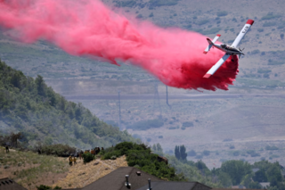
Wildfire Smoke Will Likely Kill Thousands More Americans Each Year
A new analysis finds that 30,000 more Americans are expected to die from wildfire-smoke exposure annually by 2050
-
Bridging Geospatial Science and Urban Humanities at the Global (Un) Conference
Yeim We presented geospatial research on street vending, policing, and racial inequality in LA at the Urban Humanities Global (Un) Conference.
-
Designing Cities to Go the Distance
Dr. Seto estimates that “urban expansion will result in building a city equivalent in size of New York City every eight days for the next 35 years.”
-
Yale Ancient Pharmacology Program Summer 2025 Fieldwork Report
YAPP combined multispectral & thermal imaging, ethnobotanical surveys, and residue analysis to study ancient medicine.
-
Variations in Climate Change Belief Systems Across 110 Geographic Areas
Belief systems about climate change are more tightly connected in richer, information-dense regions and looser in poorer or fossil-fuel reliant areas.
-
Public Opinion on Climate Attribution: Majorities of Americans think global warming is affecting extreme weather events
Majorities of Americans believe global warming is already affecting extreme weather like heatwaves, wildfires, droughts, floods, and sea-level rise.
-
Climate change is affecting growing season for NYC trees, Yale study finds
Prof. Seto found that climate change and urban heat delay spring leaf-out in NYC trees by disrupting winter cues.
-
Searing heat draws visitors to California’s Death Valley, where it’s tough to communicate the risks
Dr. Jennifer Marlon noted that heat concern fades within a year and urged clear, visual, and community-based messaging to sustain awareness.
-
Urban Heat Is Delaying Spring in NYC’s Parks
Juwon Kong, a postdoctoral associate in the Seto Lab, finds that urban heat is delaying, not advancing, spring in New York City’s parks.
-
Yale Planetary Solutions
Centering Knowledge Exchange and Practical Implementation in Carbon Accounting and Biodiversity Conservation
Yale-led workshop at Great Mountain Forest explored affordable tech (LiDAR, drones) to improve global forest carbon monitoring and conservation.
-
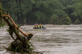
Extreme weather events like Texas rain are more likely to occur due to climate change, scientists warn
Dr. Marlon noted that flash flooding isn’t new but has worsened with global warming, urging action on climate change and fossil fuel dependence.
-
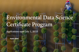
Environmental Data Science Certificate: Yale’s Online Program for Tackling Real-World Challenges
Yale’s online Environmental Data Science Certificate teaches key data skills to tackle real-world environmental issues. Applications open July 1, 2025
-
Yale School of Public Health
A Data-Driven Approach to Understanding Church Closures
Dashboard maps U.S. church closures and health impacts using county data, built with Yale Center for Geospatial Solutions.
-
Is the West doomed to burn? More like destined, wildfire experts say
Dr. Marlon warned that wildfire has become the new baseline in the Western landscape—but emphasized that “doing nothing is not a neutral choice.”
-
Geospatial Solutions Center Will Expand Yale’s Expertise
Yale has launched a new Center for Geospatial Solutions to enhance its research, training, and infrastructure in geospatial science and data analysis.
-
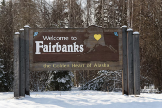
Alaska just issued its first-ever heat advisory. Here’s why.
Dr. Marlon emphasized that heat advisories are vital for protecting lives, especially in places like Alaska unaccustomed to extreme heat.
-
My Semester at YCGS: From Event Planning to Honoring Dr. Tomlin
Emmitt Thulin, a student Event Coordinator, reflects on organizing a heartfelt tribute to Dr. Dana Tomlin, marking a meaningful semester at the YCGS.
-
Interview with Dana Tomlin
Yale Professor Dana Tomlin, pioneer of Map Algebra and a founding figure in GIS, reflects on his career and how he helped shape geospatial analysis.
-
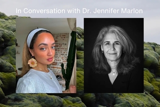
Climate 101: I Asked A Yale Climate Scientist About The LA Wildfires
In Conversation with wildfire and climate researcher Dr. Jennifer Marlon
-
A new way of interpreting data — the GIS Accelerator Program
Miriam Olivares emphasized that the GIS Accelerator program’s success stems from participants’ eagerness to learn and the Jill Kelly’s teaching.
-
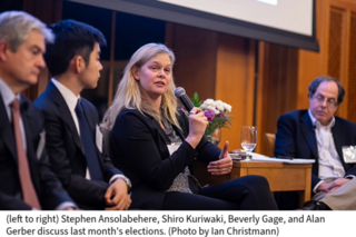
Analyzing Election Maps: Insights from Yale’s Post-Election Panel
Moderated by ISPS Director Alan Gerber, Sterling Professor of Political Science, the event featured Beverly Gage, John Lewis Gaddis and Shiro Kuriwaki
-
YCEO News
YCEO and OEFS Students Marvel at Celestial Wonder: New Haven’s Spectacular Eclipse Viewing
The Yale community gathered at Sachem’s Wood on April 8, 2024, to witness a breathtaking 91% solar eclipse.
-
Yale to launch new Center for Geospatial Solutions
Yale will create a new Center for Geospatial Solutions (YCGS) to enhance the university’s research, training, and engagement infrastructure.
-
PhD Candidate Yichen Yang Wins the Yale University’s 2022 Esri Innovation Program (EIP) Student of the Year
Yichen Yang, a PhD Candidate in Yale School of the Environment, has been awarded Yale University’s Esri Innovation Program (EIP) Student of the Year.
-
YCEO News
A New Web App for Investigating Global Urban Heat Islands
Global study maps UHI in over 9,500 cities using MODIS and Google Earth Engine, offering a web app with 16 years of high-resolution global heat data.
-
YSE News
Center for Earth Observation Turns 25 Amidst ‘Golden Age’ of Remote Sensing
Remote sensing’s growth and YCEO’s 25 years of training highlight Yale’s expanding Earth observation expertise and the center’s leadership transition.
-
YIPS
Are drones coming to Yale?
Yale’s new drone workshop shows how UAS can create ultra-detailed 3D models, expand remote sensing research, and inspire student projects from mapping
-
YCEO News
Space Archaeology Lecture
Yale alum and TED Prize winner Sarah Parcak returns April 6 to discuss her pioneering satellite-based archaeology and citizen science initiatives
-
YCEO News
Training in Geospatial Analysis of Disease Vectors: A Collaborative Workshop in Muguga, Kenya
Workshop in Muguga trained researchers in open-source GIS, remote sensing, and ecological modeling to map tsetse flies, supported by Yale collaborator
-
YSE News
Urban Heat — Not a Myth, And Worst Where It’s Wet
Yale study finds convection, not lost vegetation, is the main driver of daytime urban heat islands, especially in wet cities, reshaping strategies for


Stay Connected
Join our social channels and newsletter for updates on geospatial science news and events.